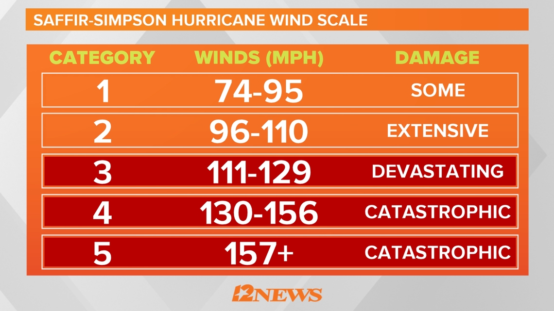
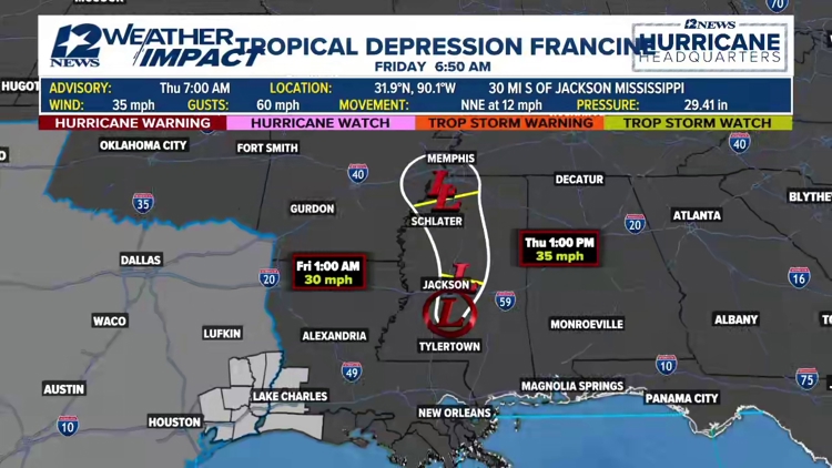
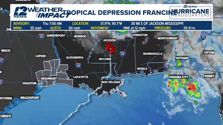
BEAUMONT, Texas — Francine weakened Thursday morning becoming a tropical depression as it moved north over south central Mississippi with maximum sustained winds of 35 mph. Then storm had made made landfall in Terrebonne Parish Wednesday evening as a category two hurricane.
7 a.m. update from the National Hurricane Center
At 7 a.m. Thursday, Tropical Depression Francine was moving north-northeast and was located about 30 miles south of Jackson, Miss.
Francine is moving toward the north-northeast near 12 mph. A turn toward the north is expected during the next day or so, with some decrease in forward speed.
On the forecast track, the center of Francine will move over central and northern portions of Mississippi through early Friday.
Maximum sustained winds have decreased to near 35 mph with higher gusts. Continued weakening is forecast, and Francine is expected to become a post-tropical cyclone later today.
Francine moves through the Gulf of Mexico
Francine Watches and Warnings
The Storm Surge Warning has been discontinued between Grand Isle, La. and the mouth of the Pearl River
The Tropical Storm Warning has been discontinued for the coasts of Louisiana, Mississippi, and Alabama, including Lake Maurepas, Lake Pontchartrain, and metropolitan New Orleans.
A Storm Surge Warning is in effect for:
- The mouth of the Pearl River to the Mississippi/Alabama Border
- Lake Maurepas
- Lake Pontchartrain
Live tropical weather loop
What is a Storm Surge Watch
A Storm Surge Watch means there is a possibility of life-threatening inundation from rising water moving inland from the coastline, in the indicated locations during the next 48 hours.
What is a Hurricane Watch
A Hurricane Watch means that hurricane conditions are possible within the watch area. A watch is typically issued 48 hours before the anticipated first occurrence of tropical-storm-force winds, conditions that make outside preparations difficult or dangerous.
What is a Tropical Storm Watch
A Tropical Storm Watch means that tropical storm conditions are possible within the watch area, generally within 48 hours.
Live tropical tracker
2024 Hurricane season outlook
The 2024 Atlantic Hurricane Season is nearly here and we want to make sure you're prepared. According to Colorado State University, it's expected to be a busy season, but regardless of projections, it just takes one storm to cause mass devastation and life-changing effects. So make sure you have everything you need to keep yourself, your home and your family safe. And make sure you have the 12News app to stay updated when you're not in front of your TV or computer.


Colorado State University issues a hurricane season forecast well before June 1, and this year, they called for an active season. How active?
On average, the Atlantic sees about 14 named storms each hurricane season. Of those, seven become hurricanes with three becoming major (Cat-3 or above) storms. The CSU forecast is significantly above that normal. They believe we will see 23 named storms, 11 hurricanes with five of those becoming major hurricanes.


Be prepared if a storm comes our way
BEFORE THE STORM
- Make a home inventory
- Have a current copy of your declarations page that has your policy number and your agent's number
- Review your policy with your insurance agent to determine if you have adequate coverage
- Repair loose boards, shingles, shutters and downspouts to prevent them from becoming an issue in high winds or torrential rain
- Have an evacuation plan, and include plans for your pets
- Make sure your emergency equipment is in working order, including a battery-powered radio, flashlights and extra batteries. Also, make sure to gather all medicine, replenish your first-aid kit and stock a week's worth of non-perishable food and water
- Charge your cell phone and fill your car with gas
- Program all emergency phone numbers
DURING THE STORM
- If you are advised to evacuate, leave as soon as possible. Retain all related receipts - they may be considered in your claim. If you aren't in a recommended evacuation and you plant to stay home, stay informed by listening to weather alerts
- Keep windows and doors closed at all time, and, if possible, board them up with wooden or metal shutters
- Stay away from the windows and in the center of the room, or, stay in an interior room
- Avoid flood water, as it may be electrically charged from downed power lines
- Check on family members and friends
AFTER THE STORM
- Check to be sure your family members are safe
- If you did evacuate, wait for official notice that it is safe to re-enter your neighborhood and your house
- Document damaged property, and take photos and videos. Don't dispose of any damaged items without approval
- Keep a record of any temporary repairs or expenses to prevent further damage to your property.
GET NEWS & WEATHER ALERTS | Download the 12News App to your mobile device


