
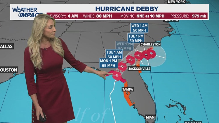
HOUSTON — Debby has made landfall in northern Florida as a category 1 hurricane with major flooding expected in the Southeast U.S
The storm made landfall just after 7 a.m. Monday, according to the Associated Press. Debby later weakened into a tropical storm.
Forecast models suggest Debby could stall, bringing catastrophic rainfall to Florida, Georgia, and South Carolina over the coming days.
Rainfall amounts are expected to range from 6-8" across north Florida. As the storm stalls near the Georgia coast, rainfall accumulations will range from 10-20" with some areas receiving close to 30".
Considerable Flash Flooding is ongoing in the Tampa area. Debby looks to bring a potentially historic amount of rain. In addition to the heavy rain, a storm surge of up to 10 feet will bring a concern for life-threatening flooding.
Debby is the fourth named storm of the Atlantic season. It's the second hurricane. The first was Beryl, which came ashore near Matagorda Texas on July 8 and took a path right through the Houston area.
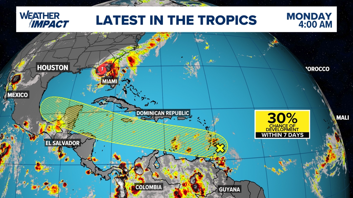
Another disturbance in the tropics
The National Hurricane Center has highlighted another disturbance in the Atlantic Ocean just north of South America. This area has a 30% chance of development within the next seven days.

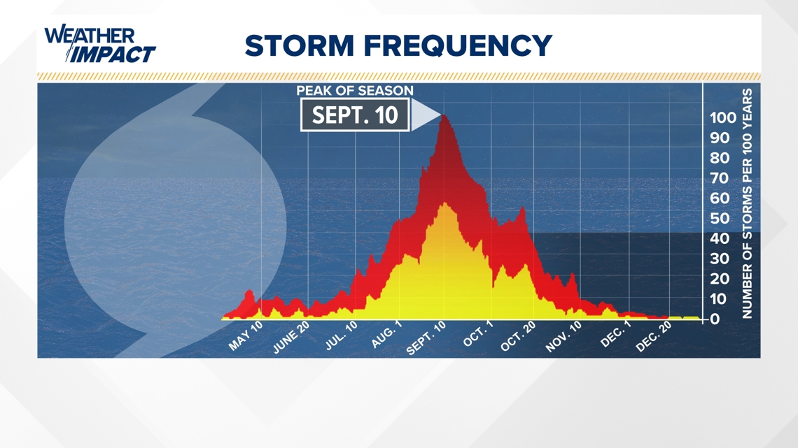
While Debby will not impact Southeast Texas, it does serve as an important reminder that we’re entering the part of the Atlantic Hurricane Season that tropical activity picks up. While the statistical peak of the season is Sept. 10, activity typically increases mid-August as it approaches the peak.