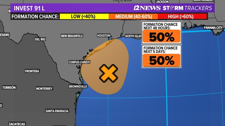
BEAUMONT, Texas — The 12News StormTrackers are closely watching a tropical disturbance in the Gulf of Mexico that will soon bring more rain to the Texas coast, including the Southeast Texas region.
The well-defined system, called Invest 91L, now has a 50% chance of further development, according to the National Hurricane Center. That's down from 60% Friday afternoon as it ran out of time to get better organized.
"Close, but no cigar," says 12News Chief Meteorologist Patrick Vaughn who tells us he just doesn't think Invest 91L will become a tropical depression.
"A dry slot is being pulled into that developing circulation, tropical systems hate dry air," KHOU 11 Chief Meteorologist David Paul said
That dry air could weaken the system and stop it from being a big rainmaker but we're not in the clear yet.
"Only a slight increase in thunderstorm activity could result in the formation of a tropical depression or storm before the system moves inland along the Texas coast overnight," the National Hurricane Center said in its 7 p.m. update.
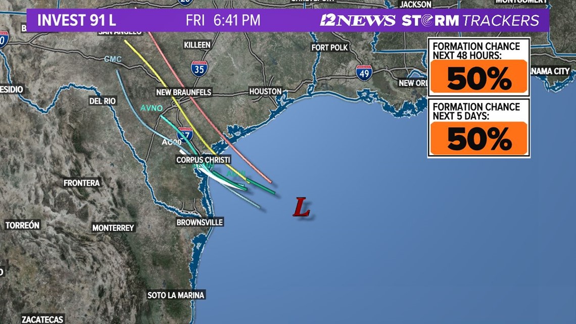
Invest 91L is expected to head toward the Corpus Christi area late Friday and that will put the Houston region on the wet side so you still need to stay weather aware with 12News.



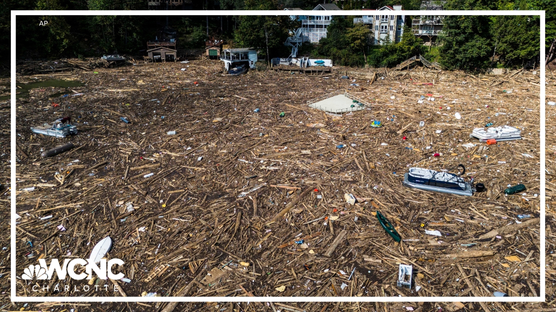
Even without widespread concerns of flooding, if you have outdoor plans for outside this weekend, you'll want to have a backup plan for indoors.
As of Friday afternoon, NOAA's three-day rain totals map showed that most of the Texas coast from Corpus Christi to Beaumont and Orange can expect about an inch of rain overall over the next 72 hours. That is a decrease from earlier models that had some areas getting perhaps three inches of rain.

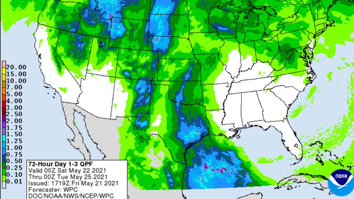
Rain is possible from Corpus to Louisiana
On Thursday, the National Weather Service said conditions are expected to be "marginally conductive" for development over the next day or so. They expect heavy rain anywhere from Corpus Christi and areas east into Louisiana, the wet side of the system.
Even without widespread concerns of flooding, if you have outdoor plans for outside this weekend, you'll want to have a backup plan for indoors.
Hurricane season officially starts June 1.
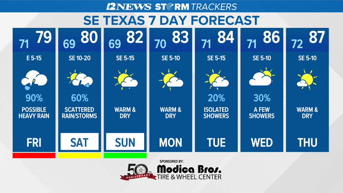
Southeast Texas 7-day forecast

Track the weather
Latest forecast from the National Hurricane Center...
Surface observations and recent satellite wind data indicate that a well-defined low pressure system over the western Gulf of Mexico has winds of 30-35 mph near and east of the center.
The associated shower and thunderstorm activity remains limited, but any increase in this activity may result in the formation of a short-lived tropical depression or storm before the system moves inland over the northwestern Gulf coast tonight, and potential tropical cyclone advisories may be needed as early as this afternoon.
Regardless of development, the system could produce heavy rainfall over portions of southeastern Texas and southwestern Louisiana through Saturday.
Given the complete saturation of soils with ongoing river flooding along the Texas and Louisiana coastal areas, heavy rain could lead to flash, urban, and additional riverine flooding across this region.
- Formation chance through 48 hours...medium...60 percent.
- Formation chance through 5 days...medium...60 percent.
Be prepared if a storm comes our way
BEFORE THE STORM
- Make a home inventory
- Have a current copy of your declarations page that has your policy number and your agent's number
- Review your policy with your insurance agent to determine if you have adequate coverage
- Repair loose boards, shingles, shutters and downspouts to prevent them from becoming an issue in high winds or torrential rain
- Have an evacuation plan, and include plans for your pets
- Make sure your emergency equipment is in working order, including a battery-powered radio, flashlights and extra batteries. Also, make sure to gather all medicine, replenish your first-aid kit and stock a week's worth of non-perishable food and water
- Charge your cell phone and fill your car with gas
- Program all emergency phone numbers
DURING THE STORM
- If you are advised to evacuate, leave as soon as possible. Retain all related receipts - they may be considered in your claim. If you aren't in a recommended evacuation and you plant to stay home, stay informed by listening to weather alerts
- Keep windows and doors closed at all time, and, if possible, board them up with wooden or metal shutters
- Stay away from the windows and in the center of the room, or, stay in an interior room
- Avoid flood water, as it may be electrically charged from downed power lines
- Check on family members and friends
AFTER THE STORM
- Check to be sure your family members are safe
- If you did evacuate, wait for official notice that it is safe to re-enter your neighborhood and your house
- Document damaged property, and take photos and videos. Don't dispose of any damaged items without approval
- Keep a record of any temporary repairs or expenses to prevent further damage to your property.
Also on 12NewsNow.com...

