
HOUSTON —
UPDATE: This page will no longer be updated. For the very latest Hurricane Beryl updates, check here.
_________________
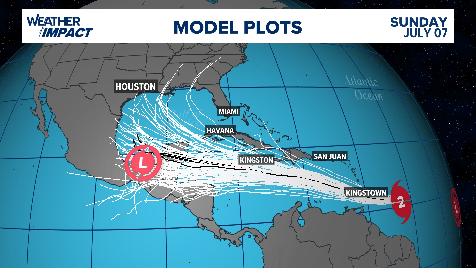
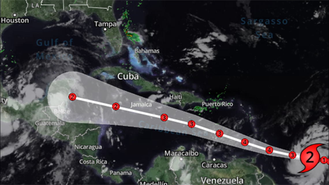
Beryl strengthened into the season's first hurricane on Saturday afternoon. By Sunday morning, it was a Category 2 storm.
With the 4 a.m. Sunday update, Beryl had maximum sustained winds of 100 miles per hour and was moving to the west at 21 miles per hour. (Update in Spanish from NHC)
The storm is expected to become a major hurricane before it reaches the Windward Islands early Monday, according to the National Hurricane Center.
Watches and warnings in effect
Hurricane Warnings are in effect for much of the Windward Islands.
Beryl path

Potential threats
Beryl is expected to be a major hurricane when it reaches the Windward Islands early Monday. It’s expected to bring destructive hurricane-force winds and life-threatening storm surge. Heavy rainfall and localized flooding along the Windward Islands is expected late Sunday and Monday.
Track the storm
Hurricane Season links
Hurricane season 2024 forecast
Colorado State University released its forecast update for the 2024 hurricane season, maintaining that it will be a busy one. In April, they predicted that we could see 23 named storms and 11 hurricanes with five becoming major hurricanes. They blame the extremely warm tropical Atlantic and likely “La Niña” as the primary reasons.
RELATED: Colorado State University releases hurricane season forecast update, maintains it will be a busy one
On average, the Atlantic sees about 14 named storms each hurricane season. Of those, seven become hurricanes with three becoming major (Category 3 or above) storms.
Why such an active season? Dr. Phil Klotzbach, lead forecaster at CSU, says it's because of two main factors -- above-normal sea surface temperatures and expected La Niña conditions this summer. The warm water adds more energy to the tropics, making fuel for these storms more available. But perhaps more importantly, La Niña usually reduces vertical wind shear.
Winds blowing across a developing or mature tropical system can keep a budding system from developing and weaken stronger storms. This reduces the total storm count. But when La Niña conditions are in place, this wind shear is often reduced. That, combined with the warm ocean surface temps is why Dr. Klotzbach believes more storms than normal will form.