
BEAUMONT, Texas —
Forecast Discussion
Another frosty night is expected mainly in the Lakes Area with a chilly morning in the Triangle as another cold front eases through by morning. Sunny skies, mild temperatures are expected Friday Afternoon.
The weekend looks great with chilly mornings and warm afternoons as a warming trend begins Sunday due to windy south winds.
Mild mornings and warm, humid afternoons are expected Monday through Wednesday with lows in the 60s and highs near 80. Dry weather or very low rain chances are forecast.
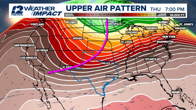
At this point, Thanksgiving looks warm, humid and windy with a slight chance. A cold front will be on the way and currently it looks like it'll push through during the late afternoon hours. However, if it speeds up or slows down, then this would change the forecast.
Southeast Texas weather


Short Term Forecast
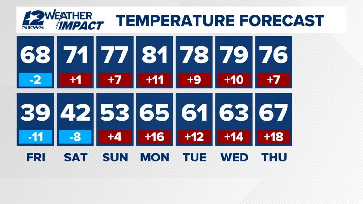
Triangle Thursday Night: Clear and cold. Low near: 39° in Beaumont, near: 39° in Orange and 43° in Port Arthur. Winds: Becoming Calm.
Lakes Area Thursday Night: Clear and frosty. Low near: 36°. Winds: Calm.
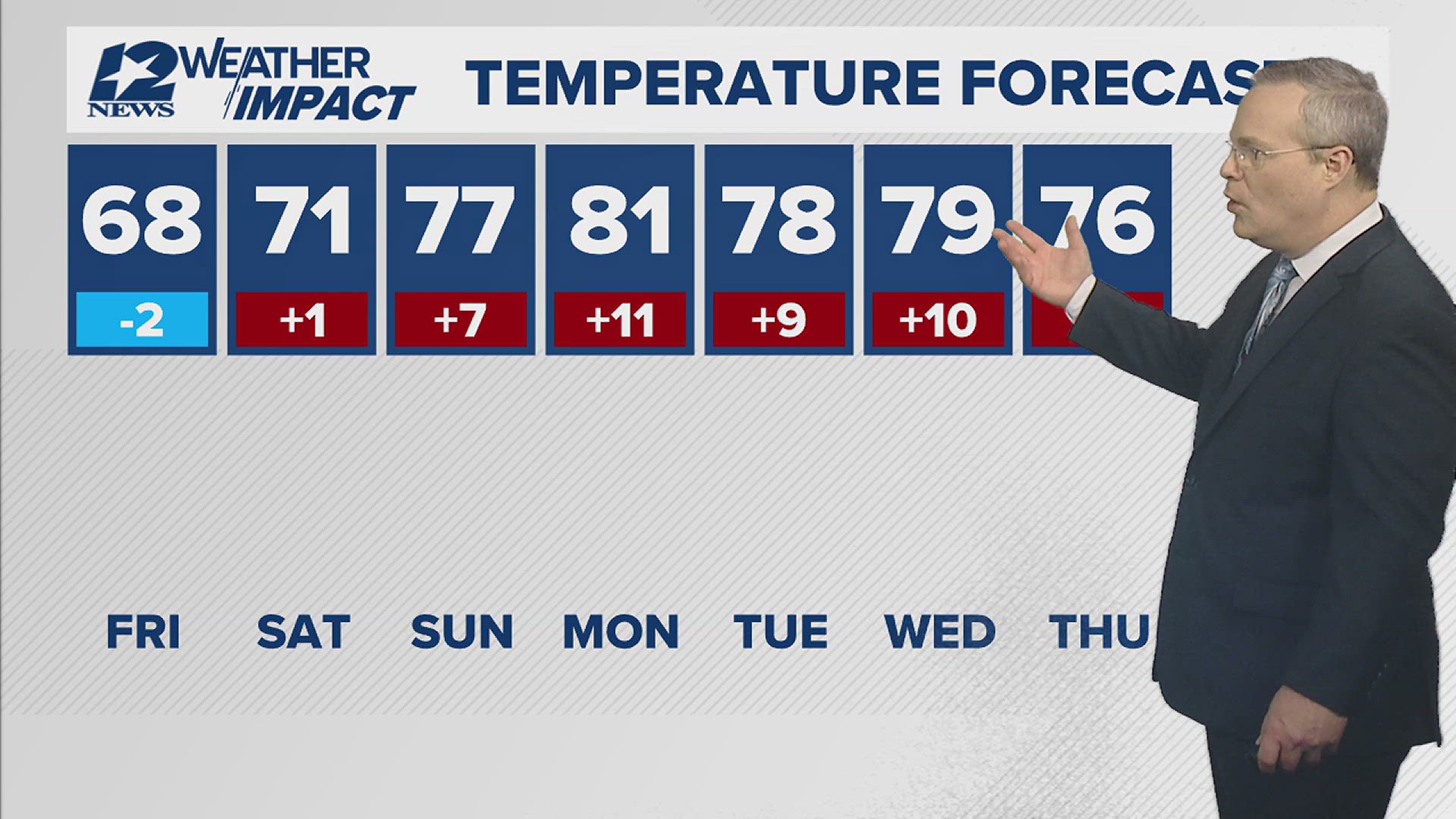
Triangle Friday: Sunny and mild. High near: 68° in Beaumont, near: 68° in Orange and near: 69° in Port Arthur. Winds: North: 2-7 mph.
Lakes Area Friday: Sunny and mild. High near: 65°. Winds: North: 2-7 mph.
Extended Forecast
Saturday (11/23): Chilly morning followed by a sunny, mild afternoon with low humidity. Low near: 42°. High near: 71°. Winds: East becoming Southeast: 3-12 mph.
Sunday (11/24): Partly cloudy, warmer and windy. Low near: 53°. High near: 77°. Winds: Southeast becoming South: 5-15 mph with gusts to 25 mph.
Monday (11/25): Partly sunny, warmer, humid and breezy. Low near: 65°. High near: 81°. Winds: South: 5-10 mph with gusts to 20 mph.
Tuesday (11/26): Partly sunny, warm and humid. Low near: 61°. High near: 78°. Winds: North turning SE: 3-12 mph.
Wednesday (11/27): Partly sunny, warm, humid and windy. Low near: 63°. High near: 79°. Winds: Southeast becoming South: 10-15 mph with gusts to 25 mph.
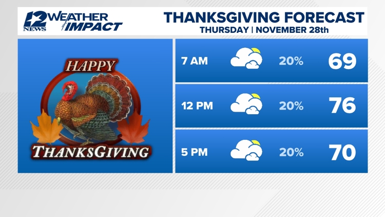
Thanksgiving Thursday (11/28): Partly sunny, warm, humid and windy with a 20% coverage of showers. Low near: 67°. High near: 76°. Winds: South shifting Northwest: 10-15 mph with gusts to 25 mph.