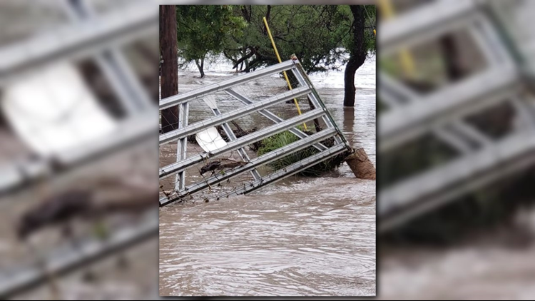
Waters along the South Llano river are rapidly rising one week after a deadly flood swept through a Llano RV park.
A flash flood warning is in effect for Llano and Gillespie counties. About 5:45 a.m. Tuesday radar indicated light to moderate rainfall would continue across those counties, according to the National Weather Service.
As much as 10 inches of rain has fallen on saturated ground during the past 30 hours, leading to multiple road closures because of high water.
Llano River is was expected to crest at 41 feet, warns meteorlogists.
"This is a very dangerous situation for people living within vulnerable areas
along the Llano River. Seek higher ground immediately," the National Weather Service warned.
Locations that will experience flooding include: Fredericksburg, Kingsland, Llano, Buchanan Dam, Gainesville, Horseshoe Bay, Buchanan Lake Village, Castell, Field Creek, Tivydale, Bluffton, Baby Head, Stolz, Crabapple, Oxford, Cherry Spring, Lone Grove, Enchanted Rock State Natural Area, Doss and Willow City.
Learn more about road closures around the state here: atxfloods.com/closures
As the Junction area continues to deal with the aftermath of the South Llano River flooding, the National Weather Service continues to update flood conditions in Central Texas
Rain from Sunday night and Monday morning caused the South Llano River to rise again
The following map shows flood conditions by category in and around the Junction area.
In addition, Cedar Creek was also on the rise Monday morning due to the weather.
The following map shows flood conditions by category in and around the Junction area.


