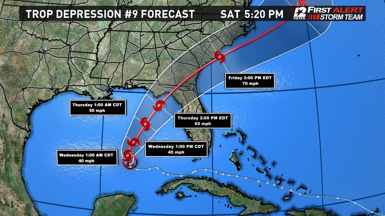
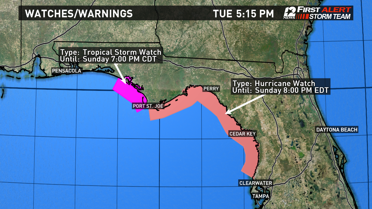
Tropical Depression #9 has yet to strengthen into a named tropical storm, however that is expected to occur within 24 hours. The middle level low and surface low are not aligned or stacked on top of each other. When that occurs, then the system will likely strengthen and become a tropical storm. Tropical Storm Watches and Hurricane Watches have been issued for Florida's Panhandle to just north of Tampa.
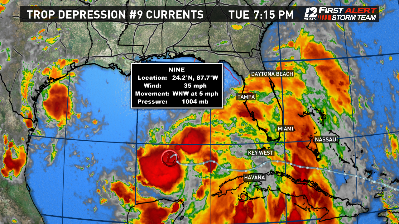
Currently Tropical Depression #9 is about 400 miles to the west of Key West and is moving West-Northwest around 5 mph. Maximum-sustained winds are at 35 mph.
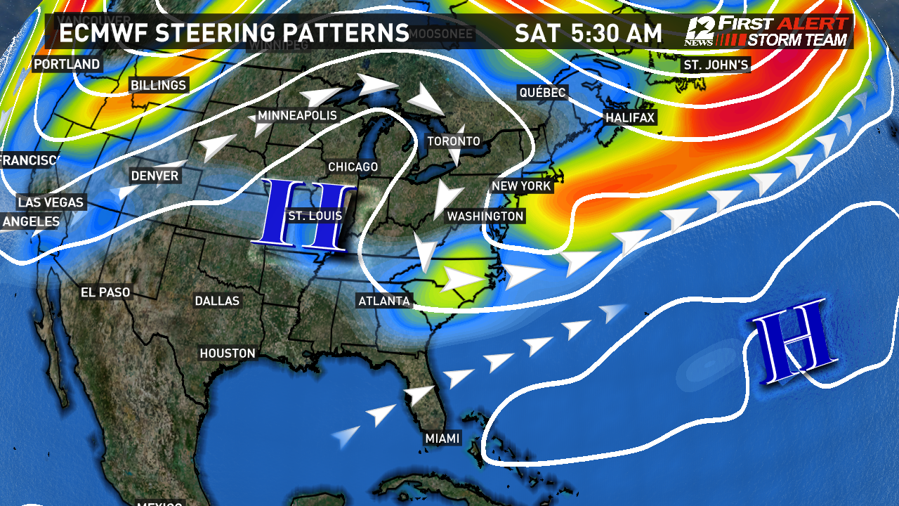
A turn to the north is expected tonight with a turn to the northeast (recurving) back towards Florida's Apalachee Bay near Perry north of Cedar Key. The model consensus continues to show a pronounced recurve with an increase in speed. This is due to an approaching upper-level trough of low pressure moving through the Mid-Atlantic.
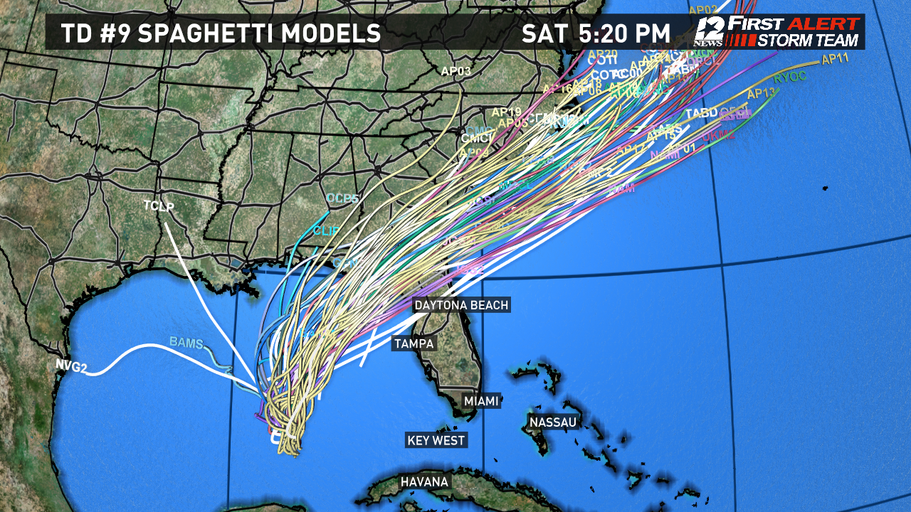
Late Thursday, a strong tropical storm or minimal hurricane is expected to make landfall.
